PROFESSIONAL GIS MANAGEMENT CONSULTED
DRONE - GPS MAPPING SERVICES
DRONE - GPS MAPPING SERVICES
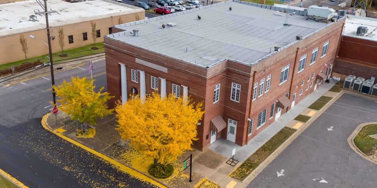
Traditional photography can be limited in its ability to capture the information a prospective tenant or buyer needs prior to leasing or purchasing a property. Who is the anchor tenant? How accessible is parking? Aerial views provided by drones can intricately detail many of the factors that can determine the success of the business customer.
Prospective homebuyers form judgements on homes and realtors based on what they see on the web. Drone photography and videography can help you demonstrate your capability while promoting a listing and highlighting its best features in a captivating fashion.

HOW DRONES HAVE CHANGED REAL ESTATE MARKETING
Differentiating property listings through high-quality photography and video pays huge dividends. Today, the latest marketing resource in real estate is the use of dramatic camera drone photography and video tours in online listings. Some agents claim that drones are the most important new technology to enter real estate marketing since the internet, and it is easy to see why. Using flying cameras, real estate photographers are producing dramatic, sweeping shots of landscapes, panoramas of ocean and mountain vistas and seamless 360-degree views of gorgeous home exteriors.
Why use real estate drone photography?
Aerial photography has been a part of real estate marketing for a long time; however, these views have traditionally been captured from helicopters and have been reserved for only the most expensive listings. Drones have significantly reduced the cost of aerial photography and has made its beautiful output affordable to all.
Real estate drones (also called unmanned aircraft systems, or UAS) are used to capture aerial views of a property’s acreage, home features and highlights. These images and videos used to be reserved for real estate agents showcasing luxury homes, but today the cost of owning a drone or hiring a professional real estate drone pilot are minimal, meaning aerial photography and video fit into the budget for just about any property.
Using aerial photography for real estate creates visual intrigue about a home and is especially valuable for the price. According to Multiple Listing Service statistics, properties with accompanying aerial imagery are 68% more likely to sell than properties without aerial imagery, and that number is only increasing.
For commercial real estate investors and developers with reach beyond a single geographic market, GEOTREAD is the ideal aerial services partner.
For many real estate agents, hiring a professional is the best option. It all comes down to your budget, real estate needs and personal preferences. Depending on how often you plan to use real estate drone photography and video.
A professional real estate drone pilot will have the proper certification, equipment and — most importantly — experience. The cost of real estate drone services can vary depending on location, equipment, time and type of service. Generally, professional real estate drone services cost anywhere from $100 for basic photography to several hundred for package deals.
Whether you own your own drone or are working with a professional, real estate drone photography requires you to follow certain rules and regulations (read all of the FAA’s drone rules here):


We'd love to hear what you have in mind for your project and how we can help out. Contact us using the form above.